Tide movement
Local water level and rate of change, plus current speed and slack where NOAA coverage exists.

 CoastCue
Fishing intelligence for the coast
CoastCue turns tide, wind, weather, daylight, moon, and coastal alerts into a practical fishing outlook and three-day planner, with every source and estimate clearly labeled.
Android first ·
One view. A better call.
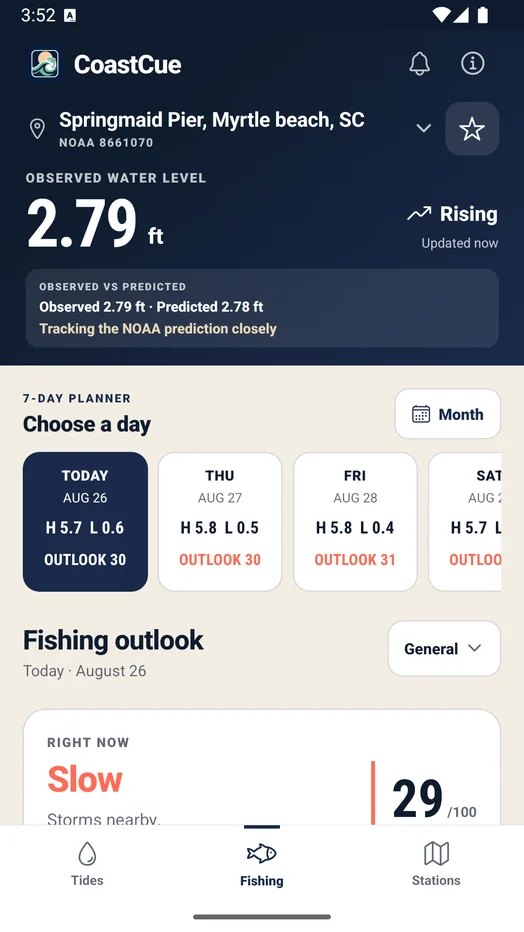
CoastCue combines trusted coastal data into an hour-by-hour outlook. It shows the shape of the day, the strongest upcoming window, and the reasons behind the forecast instead of hiding everything behind one score.
Fishing comes first
Scan the day and understand the drivers. CoastCue Pro adds locally scheduled trip alerts before conditions turn in your favor.
See the current rating, score, plain-language reason, and the shape of the next 24 hours. Fishing scores are planning estimates, not catch guarantees.
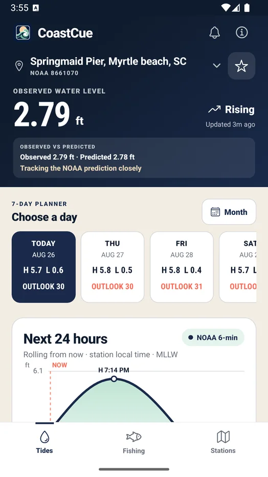
Choose a day, compare tide and fishing conditions, and keep the NOAA source, datum, and Estimated label visible. Today and the next two planner days are free; days four through seven require CoastCue Pro.
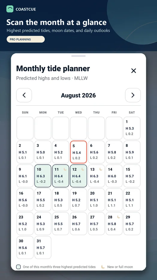
CoastCue Pro adds monthly NOAA high-and-low planning, higher-predicted-tide highlights, and new or full moon context without presenting an official king-tide designation.
Moving Water uses a separately confirmed NOAA current station where local coverage exists. Where it does not, CoastCue uses the rate of tide change because that is the better local signal. Surf responds to NWS forecast wave height, period, and wind relative to the way the coast faces.


Real inputs, practical language
CoastCue translates coastal inputs into evidence you can act on without losing the original source or label.
Local water level and rate of change, plus current speed and slack where NOAA coverage exists.
NWS forecast plus separate NDBC observation.
Speed, direction, and changing exposure.
Conditions and the near-term trend.
Dawn, dusk, and useful overlap.
Phase and timing as supporting context.
Fishing first, useful between trips
CoastCue still leads with when to fish. Paddle, Beach, and Shelling reuse the same labeled NOAA and NWS inputs for the days when your rods stay home.
Wind, wave chop, and available current context, with a prominent offshore-wind warning instead of a quiet score penalty.
Water temperature, wind, waves, active NWS alerts, and rip-current risk when the National Weather Service publishes it.
The lowest water levels stand out in the planner, making the next worthwhile low easier to compare.
Three kinds of alerts
CoastCue Pro includes optional fishing and tide-planning reminders. NWS coastal warnings remain clearly separate and do not require Pro, so an advisory is never mistaken for a fishing score.
Get notified 30, 60, or 90 minutes before a favorable saved-station window.
CoastCue Pro · scheduled locallySee active marine warnings and advisories from the National Weather Service.
Safety information · no Pro requiredOptionally track tide events or useful reference levels for a saved location.
CoastCue Pro · scheduled locallyThe trusted foundation
See the current water level, the next turns, a full 24-hour curve, and the first three planner days for free. Where NOAA provides a live sensor, CoastCue also shows the observed offset and corrected upcoming estimates for free. CoastCue Pro adds named My Spots windows.
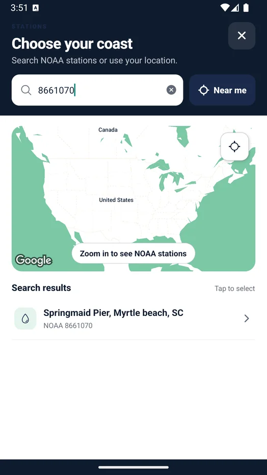
Built around your water
Search by city, state, or station ID, use Near me, or choose a saved NOAA station. Save the places you fish and return to their latest cached forecast when reception is weak.
Trust the label
CoastCue uses NOAA CO-OPS tide data and local current predictions where coverage exists, National Weather Service forecasts and alerts, and National Data Buoy Center observations. Forecast and observed wave values are never blended.
Station, datum, bin, unit, coverage, and data age stay visible.
Forecast context and active marine alerts remain distinct.
Buoy ID, distance, age, and stale status stay visible.
Free and Pro
Tides, local conditions, sensor-backed context, and the first three planner days stay free. CoastCue Pro adds four planning tools that work at every NOAA tide station. Google Play shows authoritative localized pricing and offer eligibility before purchase.
$0
$14.99 founding first year
Now on Android
Install the free core app today, then add CoastCue Pro in the app if the seven-day planner, monthly tides, trip alerts, and My Spots fit the way you fish.
Get it on Google Play